Around Iceland’s Ring Road in 2 weeks: Part II
Waterfalls, beaches, mountains, hot springs, volcanos, and more. Iceland, the Land of Fire and Ice, is nature at its best and the adventure of a lifetime. Our two week itinerary of Iceland took us around the Ring Road at an easy, comfortable pace – perfect for traveling with kids, and plenty of time to hike, swim, and take it all in.
Duration: 14 days
Traveled as: a family (two kids ages 5 and 7) with friends (another couple with two similar aged kids)
Type of travel: pleasure
Combined with other destinations: no
::Our two week Iceland Itinerary::
In Part I of our Icelandic adventure, we hit a number of attractions in the famous Golden Circle, and caught the not-to-be missed waterfalls along Iceland’s south coast.
The next leg of the Ring Road along Iceland’s south coast gets into volcanic territory. Nothing active now (phew), but you will pass long stretches of lava fields, and majestic ice caps and glaciers that now top old volcanoes.
Day 4 – From black sand beaches to glaciers
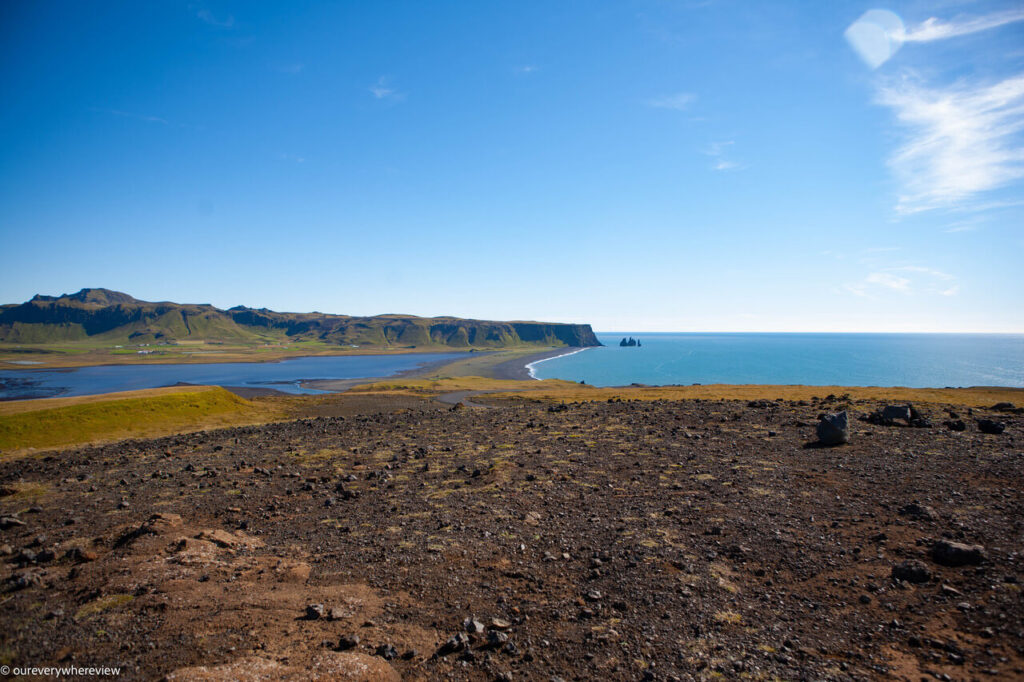
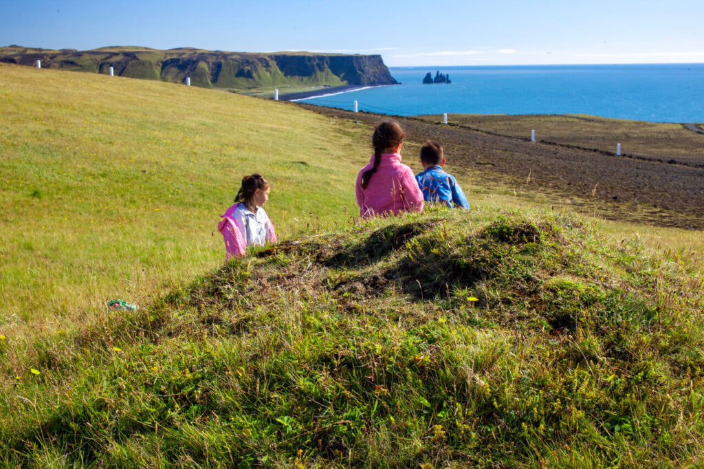
Staying overnight in Vik is prime set up for a morning of exploring Vik’s surroundings: Reynisfjara (the famous black sands beach), and Dyrholaey.
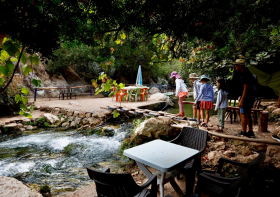
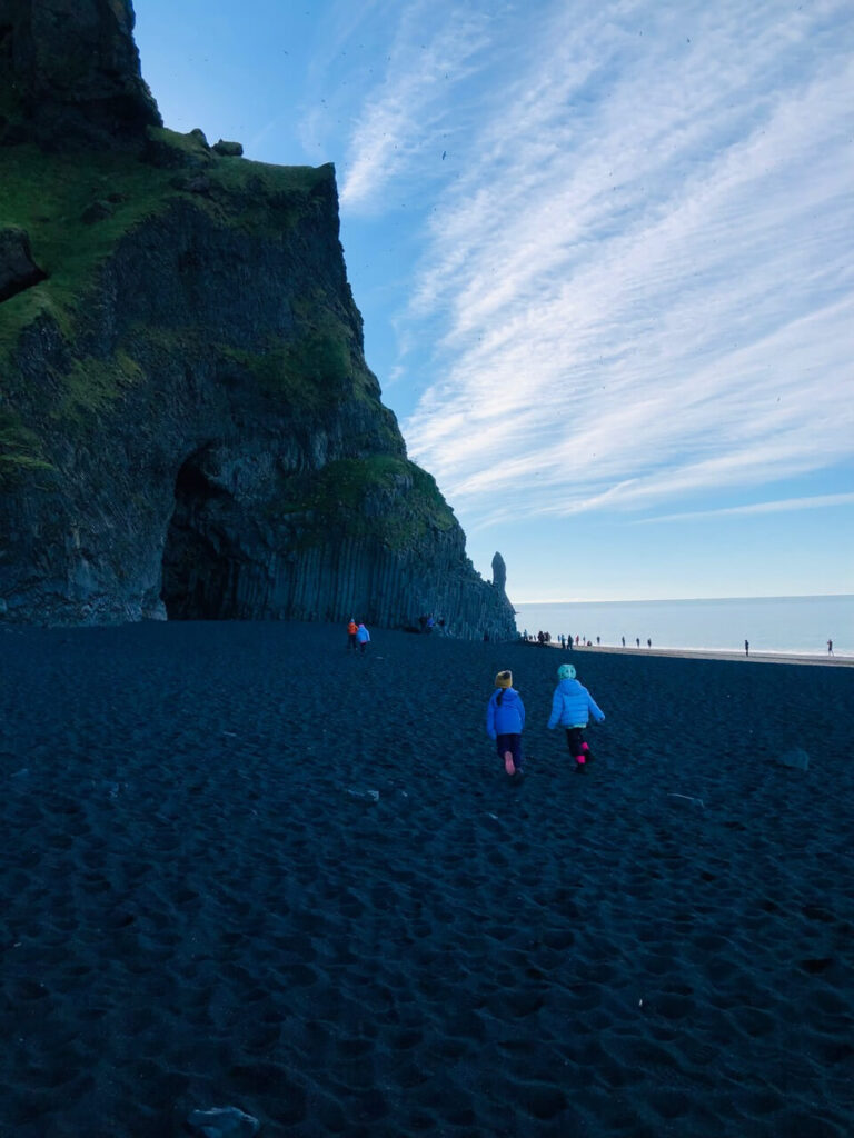
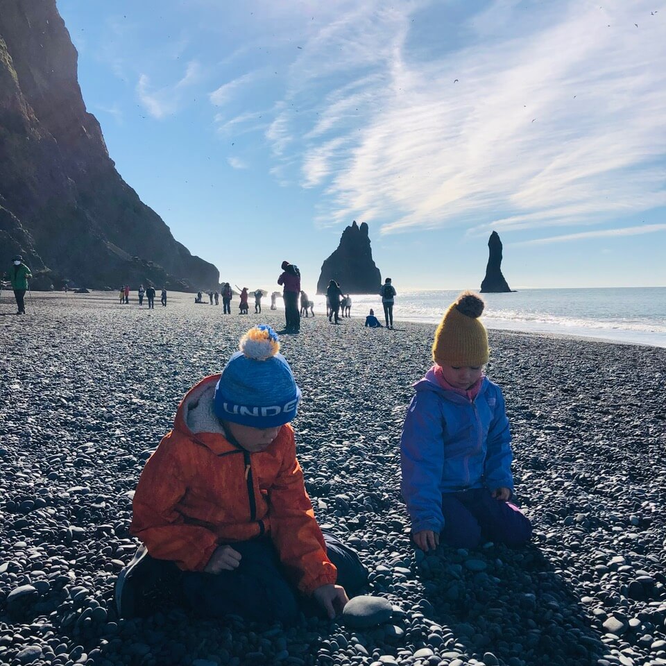
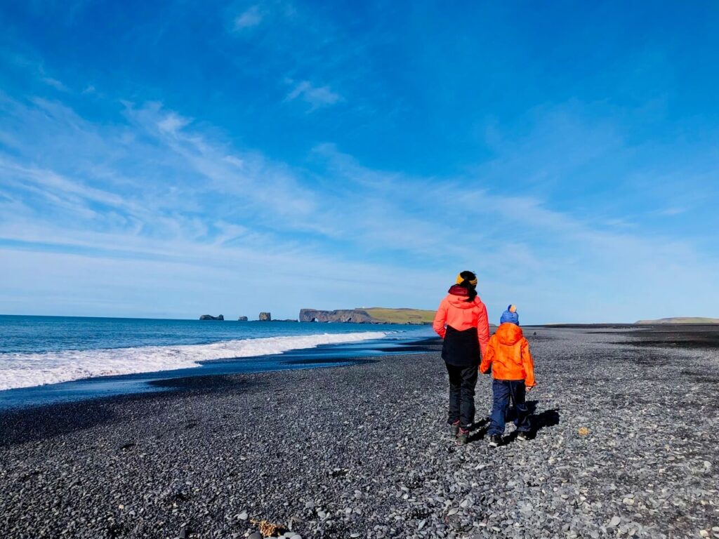
Reynisfjara
Reynisfjara is a beautiful stretch of black sand beach. It’s flanked by a wide expanse of ocean on one side and towering volcanic basalt salt columns on the other. Big S and Lil S loved this spot. They could have spent all morning exploring the caves, running up and down the beach, and climbing the basalt columns. There are Atlantic puffins and seabirds that nest in the cliffs overhead, which fly literally over your head as they make their way toward the ocean.
It was a calm sunny day when we visited, but Reynisfjara is one of the most dangerous spots in Iceland. It has unpredictable “sneaker” waves that can drag an unsuspecting visitor in and under. The recommendation is to steer clear from the water, and never turn your back to the waves.

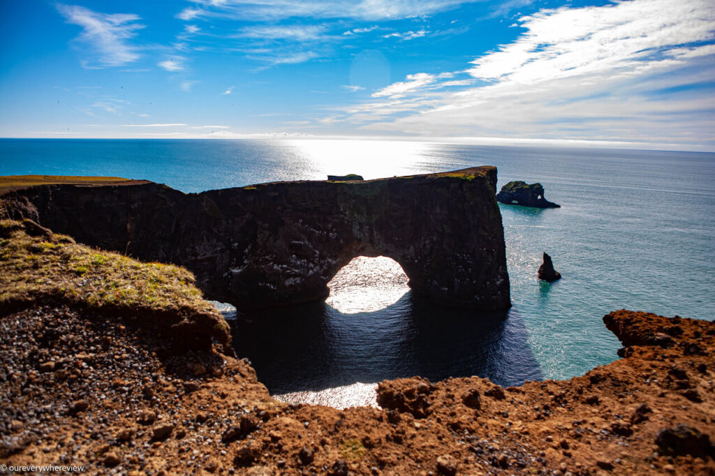
Dyrholaey
Dyrholaey is a peninsula 20 minutes away from Reynisfjara (although you need to backtrack west from Vik). The lookout at the top of the hill offers stunning views of Reynisfjara and the surrounding mountains and glaciers, the closest being Myrdalskjokull to the north. On the ocean side, (beside gorgeous ocean views), there is a dramatic stone arch. But the main reason we came up this way was for the chance to see Atlantic puffins up close. Dryholaey is one of the best places to see puffins from May to the end of August – and we were in luck! There were not many when we visited, but you can really get close without startling them.
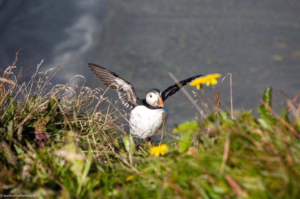
We felt like we’d hit the jackpot the last few days. A little bit of the northern lights even though it was summer, a few puffins even though we were at the end of their nesting season.
We had lunch in the RV, as there is nowhere to eat in Dryholaey (only a set of paying public restrooms). Reynisfjara does have a restaurant, but otherwise you can grab lunch as you head back into Vik.
Skaftafell National Preserve
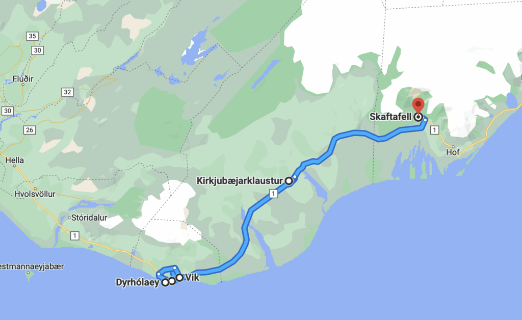
From Vik we drove directly to our next campsite at the next attraction – Skaftafell. Skaftafell is a part of Vatnajukoll National Park, at the base of Iceland’s biggest ice cap, Vatnajukoll. (There is also a hotel here, but you need to book early.)
(Kirkubaejarklaustur)
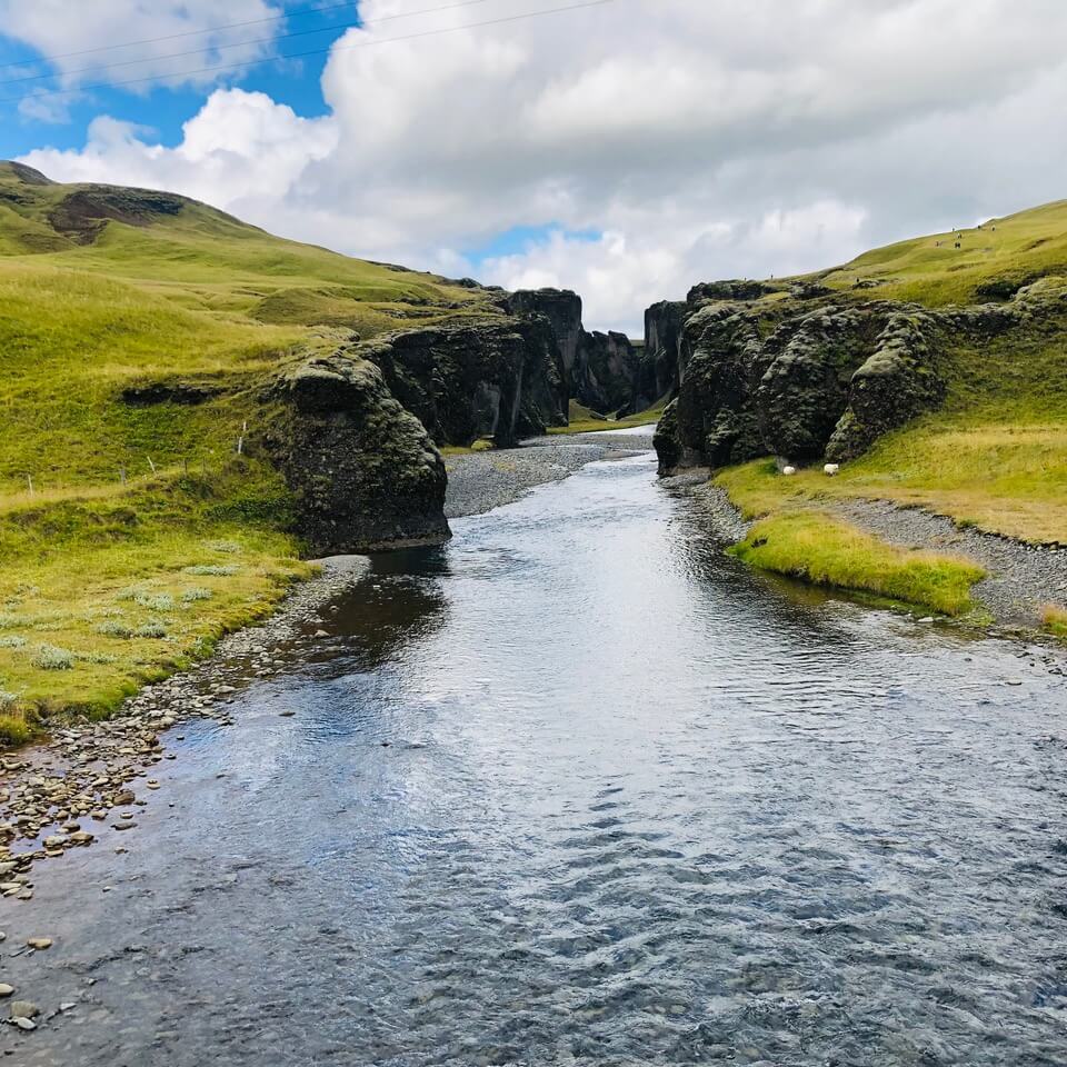
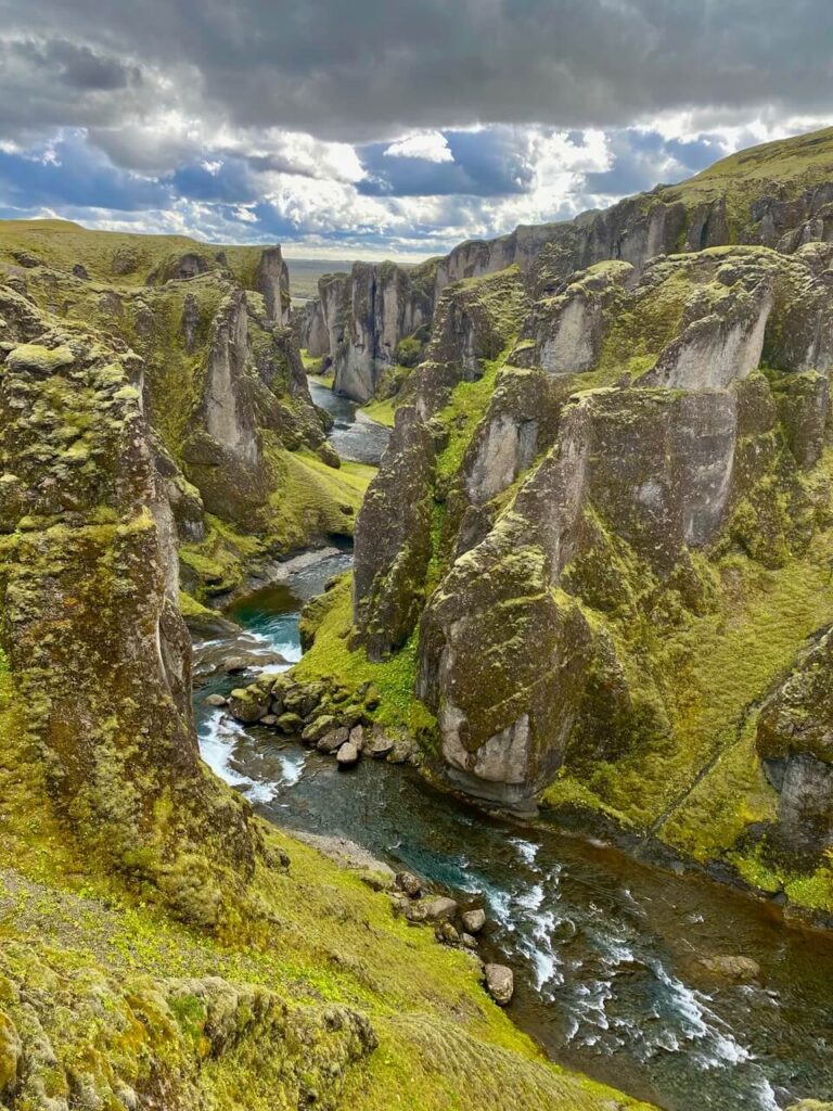
Okay, so our “driving directly” wasn’t *quite* the truth. To break up the nearly 2 hour drive, we wanted to stop and do some hiking at Kirkjubaejarklaustur (1 hour from Vik). This ungodly long name is a breathtaking canyon. The official parking lot is at the mouth of the canyon, and it is a 2km hike to get to the top. Our friends traveling in the other RV ended up at a different parking lot (and managed to capture the stunning photo below). After about half an hour of patchy wifi-signal and inability to locate the other party, we gave up and decided to move ahead with our itinerary. (As we learned later after comparing notes, you *can* take a turn up a gravel road just before you hit the parking lot, which will take you to the one at the top of the canyon. However, this is technically considered an “F” series road, and only suitable for off-roading vehicles.)
… Back to Skaftafell
Once we got to Skaftafell, the kids were definitely ready to stretch their legs. After a good run around the campground, we were ready to do some hiking. Skaftafell has two main hiking attractions – a 1.5km hike to Svartifoss, a waterfall tumbling between dramatic basalt columns, and the slightly shorter 1.1km hike to Svinafellsjokull glacier. We liked that the trails were a stone’s throw away from our campground, and we were able to explore after parking the RV for the night. It’s definitely doable to hit both, but as always, you need to pick and choose a little while travelling with kids. The kids were a little waterfall’ed out by this point, so we chose the glacier hike.
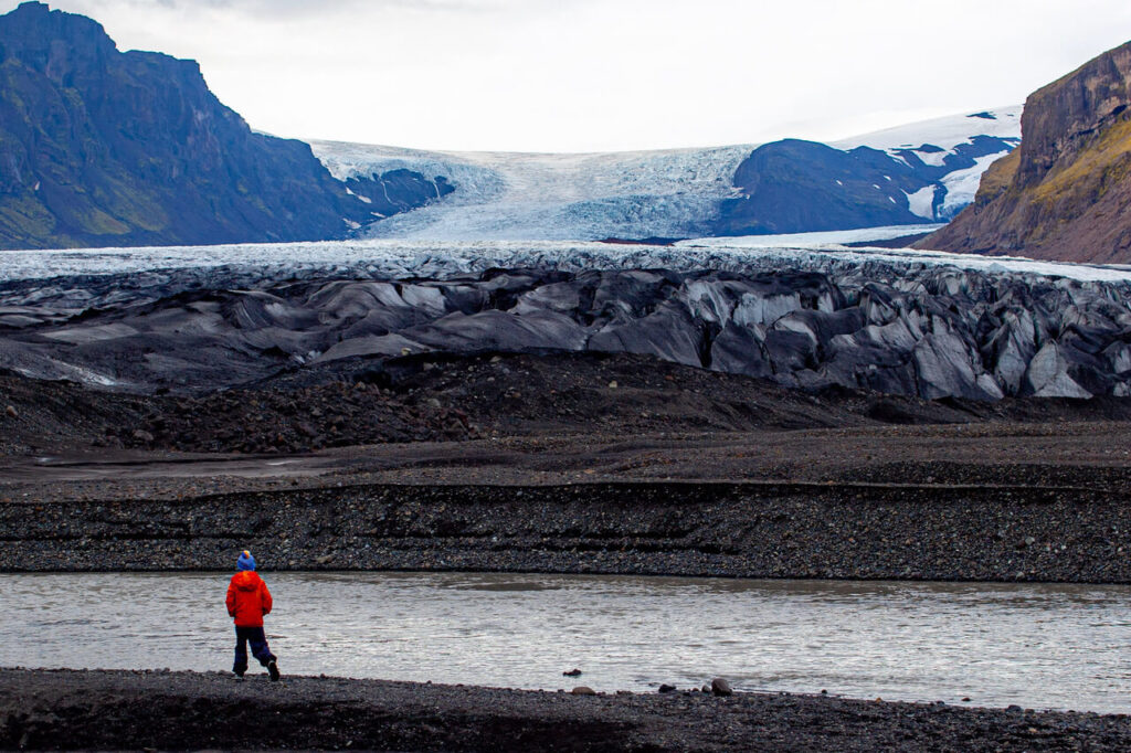
The Svinafellsjokull hike was a perfect length for the kids, and you can get right up close to the glacier and the glacier lagoon, nestled between the mountains. It’s a breathtaking spot (chilly, though), that was somehow both dramatic and very peaceful. It was Big and Lil’s S’s first glacier!
It’s also possible to arrange for glacier hiking and climbing tours, but our kids were too young for these (usually age limit of at least 8 years).
Day 5 – Jokulsarlon and Diamond Beach, Iceland’s east coast
There is quite a bit more driving from here on out. There are tons of attractions along the southwest coast of Iceland, but from this point on the attractions are further apart. We averaged 3 hours or so of driving a day for almost the remainder of the trip.
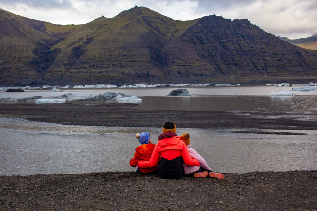
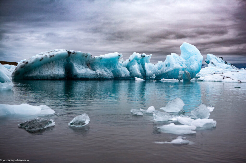
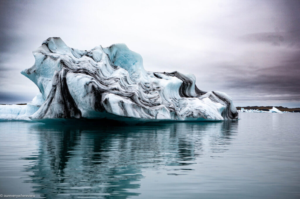
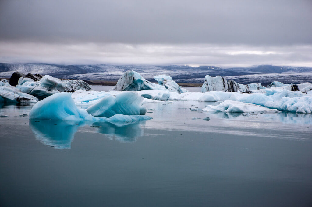
Jokulsarlon and Diamond Beach
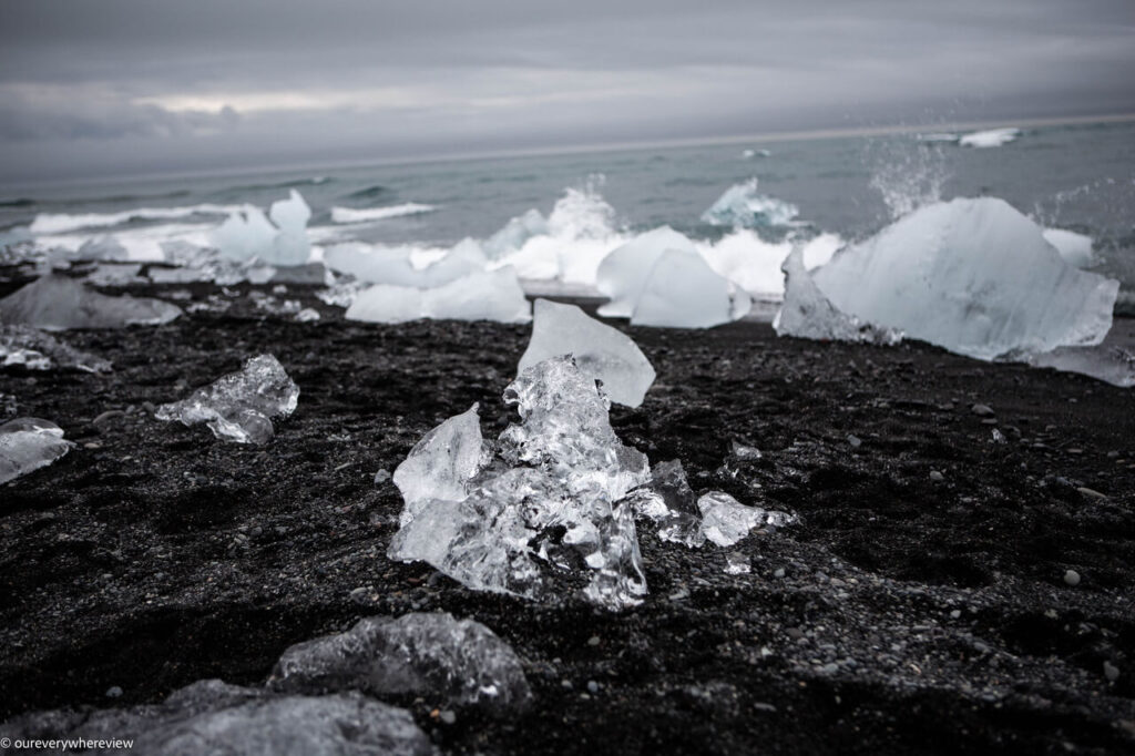
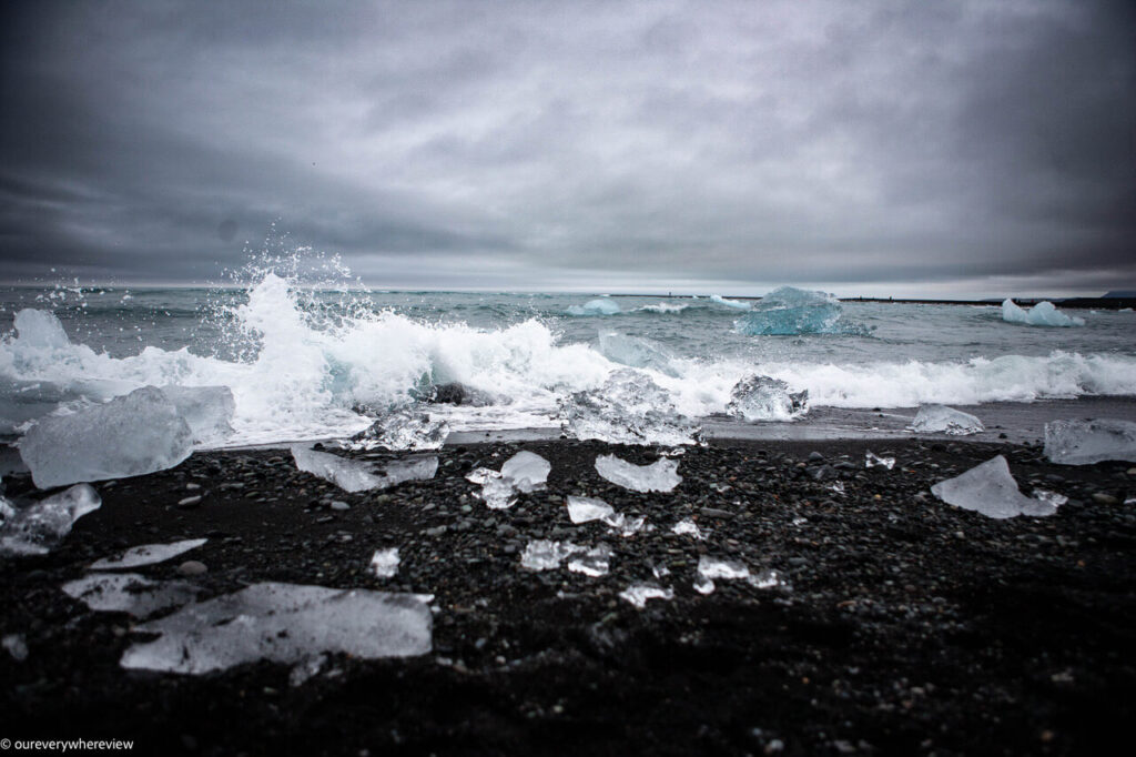
It’s an hour drive to start, from Skaftafell to Jokulsarlon and Diamond Beach. Jokulsarlon is a glacier lake of icebergs that break off from Vatnajokull. Diamond Beach is across the road, where ice chips have washed back from the ocean onto the black sand beach. There is a path that connects the two attractions.
There are short hikes around Jokulsarlon, but the best way to see this glacier lake is to take a boat or kayak tour. We took the Amphibian Boat Tour, the only one recommended for young kids. This was a 30-ish minute ride around the icebergs, and fairly informative. The kids didn’t much care to see the icebergs up close, but they loved the boat ride, and it makes for some great photos! You can also spot seals and a number of bird species.
You can easily spend several hours here. Diamond Beach, in particular, is “interactive” and a huge hit for the kids. They loved running around on the beach, admiring and playing with the bits of ice along the shore.
Hofn
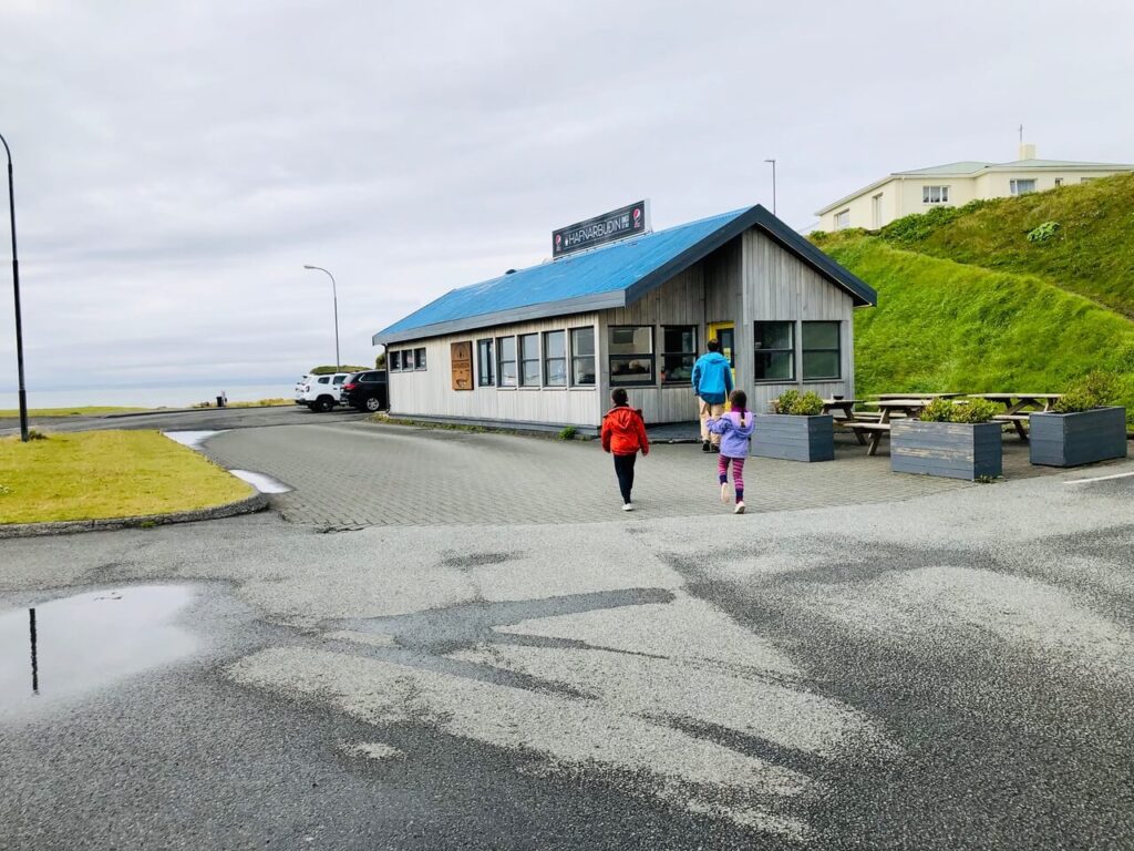
For lunch, I recommend continuing eastward approximately 50 minutes to Hofn, a small fishing town that marks the “inflection” point after which the Ring Road turns up along Iceland’s east coast. Hofn has a number of restaurants and is renowned for its seafood. We chose Hafnarbudin, a budge diner well reviewed on Tripadvisor. The menu offers seafood and classic American fare, the portions are large, the service fast. (It was early afternoon by this time, the kids were starving, and there was no way they would have been able to sit through a restaurant meal.)
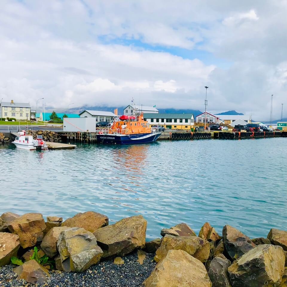
Hofn also has a photogenic, walkable coastline, and a kids playground with Big S’s new favourite thing: the bounce pillow. Once he realized almost every town has one of these, he made it his mission to hit up all of them.
Stokksnes
After lunch and a quick grocery stop we started the east coast leg of our Iceland trip.
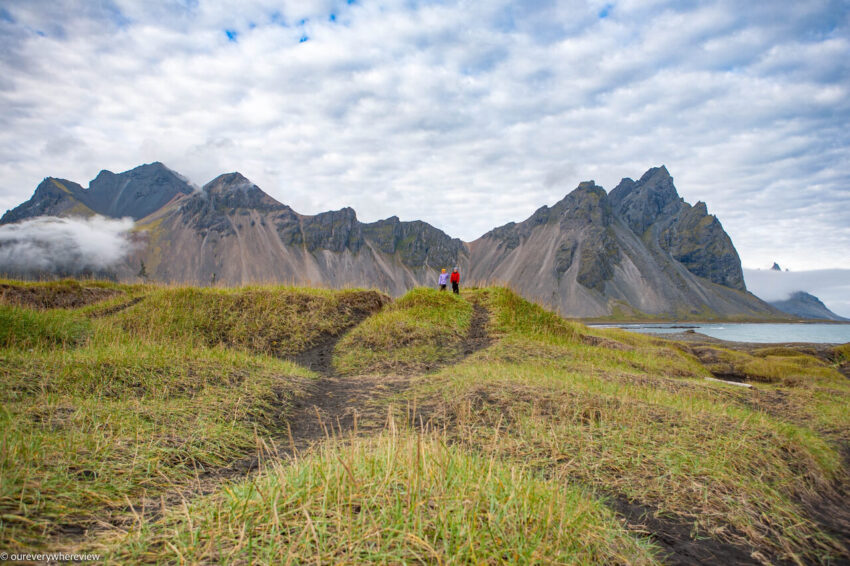
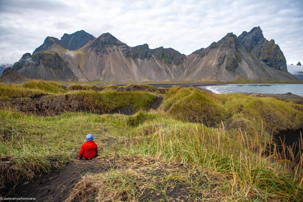
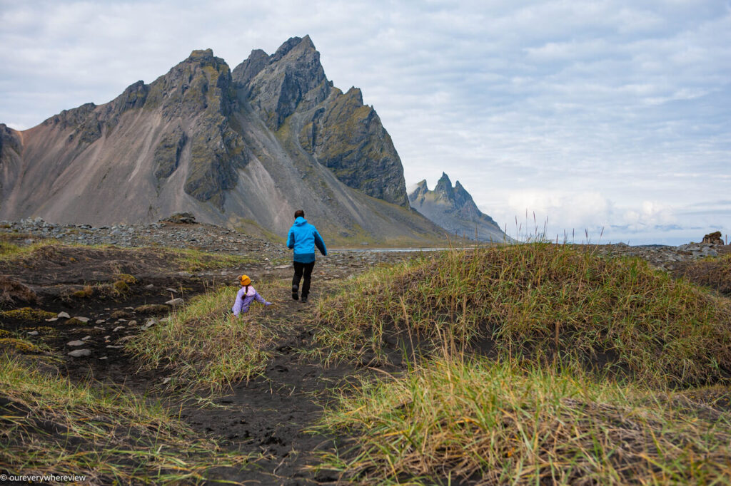
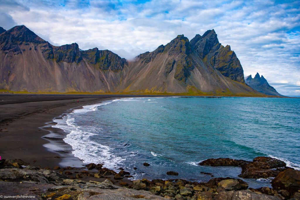
Our first stop was a short 20 minute drive away, to Stokksnes peninsula. It’s a slight detour off the Ring Road (just before a long mountain tunnel) along a bumpy gravel road, and one of the kids’ favourite spots of the entire trip. This tucked-away spot has a gorgeous view of the Vestrahorn, arguably Iceland’s most dramatic mountain, a stretch of black sands beach, a Viking village, and is the home of an (off-limits) NATO radar site. But hands down the kids’ best memory was running up and down the large black sand dunes. We couldn’t get them to leave! (And with a view like that, we certainly weren’t in a hurry to leave.)
When we finally pried them away from the dunes, we continue along the east coast. Traffic here is much quieter – many times we were the only car (well, two cars) on the road.
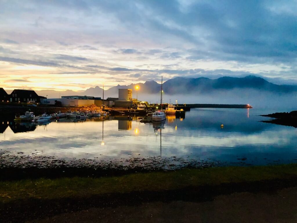
Iceland’s east coast is characterized by dramatic mountain views and little villages. We stopped in the town of Djupivogur for the night. We’d been driving for almost 1.5 hours by this point, through a thick fog along the mountainous coast (which unfortunately obscured aforementioned “dramatic mountain views”), and we were all glad to arrive at our destination. The campsite has “barrels” (rooms) for rent, as well as a hotel next door. We ended the day with some swimming at Djupivogur’s new pool.
Day 6 – Iceland’s east coast, cont.
Djupivogur
Djupivogur is Iceland’s first “slow city”, part of the global Cittaslow organization focusing on preserving the small town feel. Local sourcing and production, local art and traditions, reusing and decreasing waste, and laid back and quiet living.
The entirely of Iceland’s east coast is arguably “slow living”, and is a welcome break from the attraction-to-attraction pace of the other parts of Iceland.
We might not have meant for things to get *quite* so slow our day 6 morning. We wanted to do laundry at the campsite, as we were about halfway through the trip. Some inconsiderate jerk left the dryer door open, and we had to start the cycle all over again. But this wasn’t a terrible thing. We went for a walk, Big S found his bounce pillow and a small playground. Then the kids amused themselves in the RV while us adults had another cup of coffee and finally made good use of the camping chairs we’d lugged around all this time.
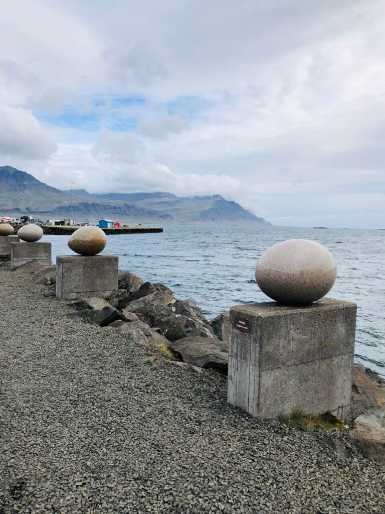
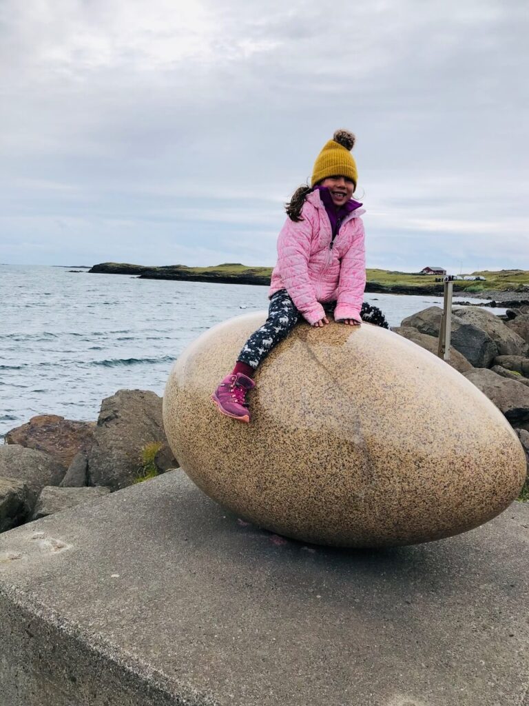
It was mid-morning by the time we set out. We stopped along the coast at Djupivogur’s Eggin I Gledivik, or “Eggs of Merry Bay”. These are sculptures of 30 some odd eggs of the local birds species, carved from granite by local artist Sigurdur Gudmundsson. The exhibit and view are lovely, although it is surrounded by an industrial area.
Djupivogur also has a natural hot spring located just off the ring road – Djúpavogskörin. We would have loved to stop over, but unfortunately it was closed, and looks like it might be closed for awhile yet (2022).
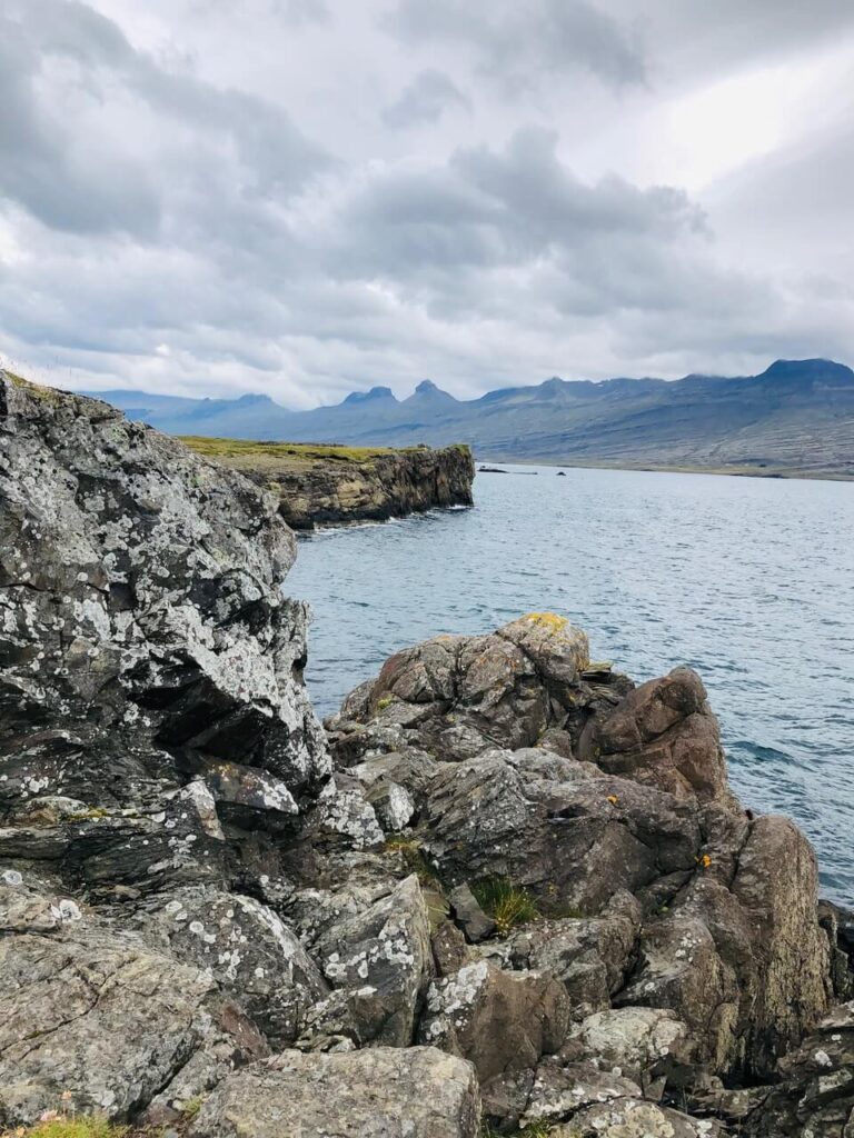
Teigarhorn Nature Preserve
A short drive away from Djupivogur is Teigarhorn. Besides being a beautiful spot with a small beach full of shells, hiking trails, and gorgeous views all around, Teigarhorn is one of the most significant zeolite mining sites in the world. I’d never even heard of this crystal until we visited this place. Zeolite is apparently used in industrial processes. The area is protected, and it is forbidden to remove any zeolite from the property. You also get a stunning view of the dramatic Teigarhorn mountain, which looks like a pyramid.
!! Route 939
The “!!” means, “do not take unless you are crazy”. 😛
But in our defence, Google told us to, and we were well on our way before we realized our rental agency specifically warned us about this route.
Google Maps will recommend Route 939 (aka the Oxi Pass) from Djupivogur to Egilsstadir, the town that marks the “infection” between the east coast and the north part of Iceland. It saves about 70 km of coastal driving along the Ring Road. (I bet it’s beautiful, but I guess we weren’t fated to see it…)
Instead, Route 939 takes you into and right through the mountains. It is a 19 km narrow, gravel road, with steep inclines up to 17%. In a motorhome, this was *very* dicey, and for a few turns I wasn’t sure we would make it. To top it off, there is no cell signal. Besides not being able to text our friends with “is this a F road????” (F for forbidden, of course. 😛 Kidding. I don’t actually know if the “F” stands for anything in Iceland’s nomenclature, but it indicates off-roading paths only.) it would have been impossible to call for help if anything had happened to our vehicle.
However, the views are stunning up there (I’m not sure if Daniel the driver was able to appreciate much – if any – of it). Dramatic waterfalls and canyons against a background of vast, desolate wilderness – it feels like a different world. Only with the bumping of the RV, it was impossible to capture a photo.
Seydisfjordur
This is a charming little town about 25 minutes East of Egilsstadir, at the edge of Iceland’s iconic east fjords. You also have to transverse a mountain, but this one was much more manageable, albeit full of hairpin turns.
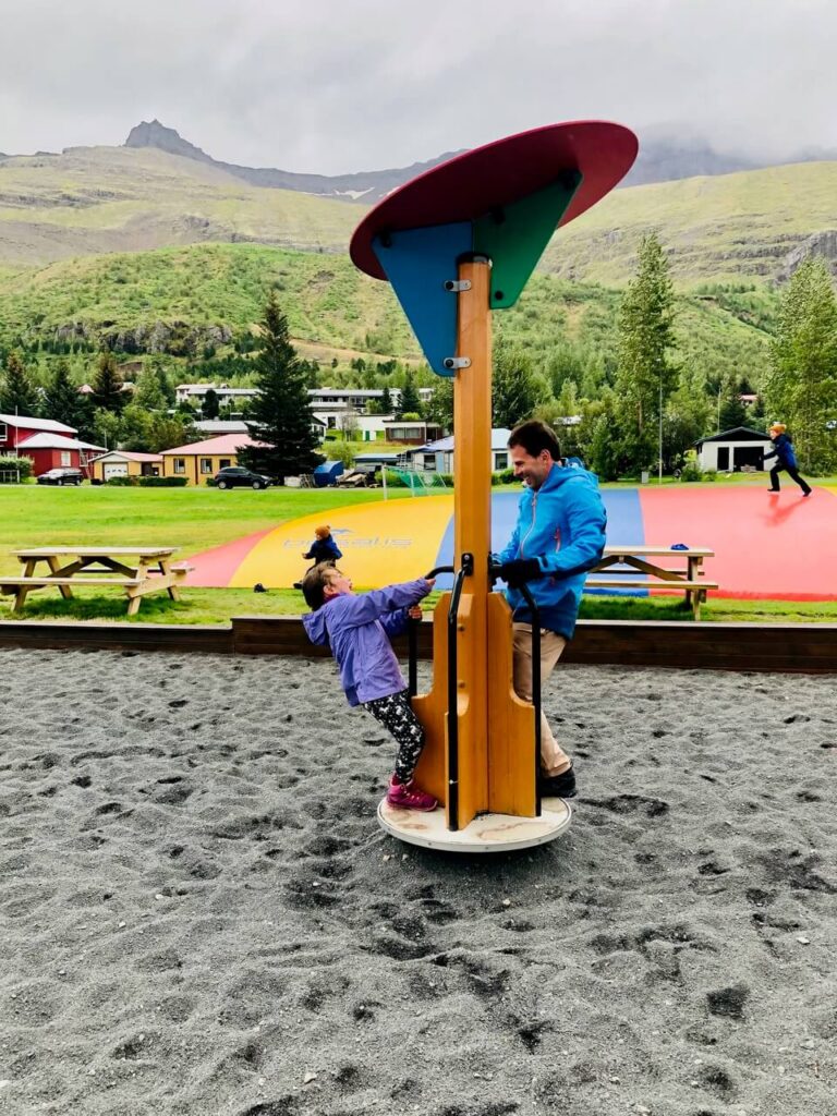
We didn’t see as much the town as we would have liked. The kids were restless from the long drive, and we spent most of our time here playing at the playground (bounce pillow: check). It was a *very* scenic playground, with mountains and waterfalls all around.
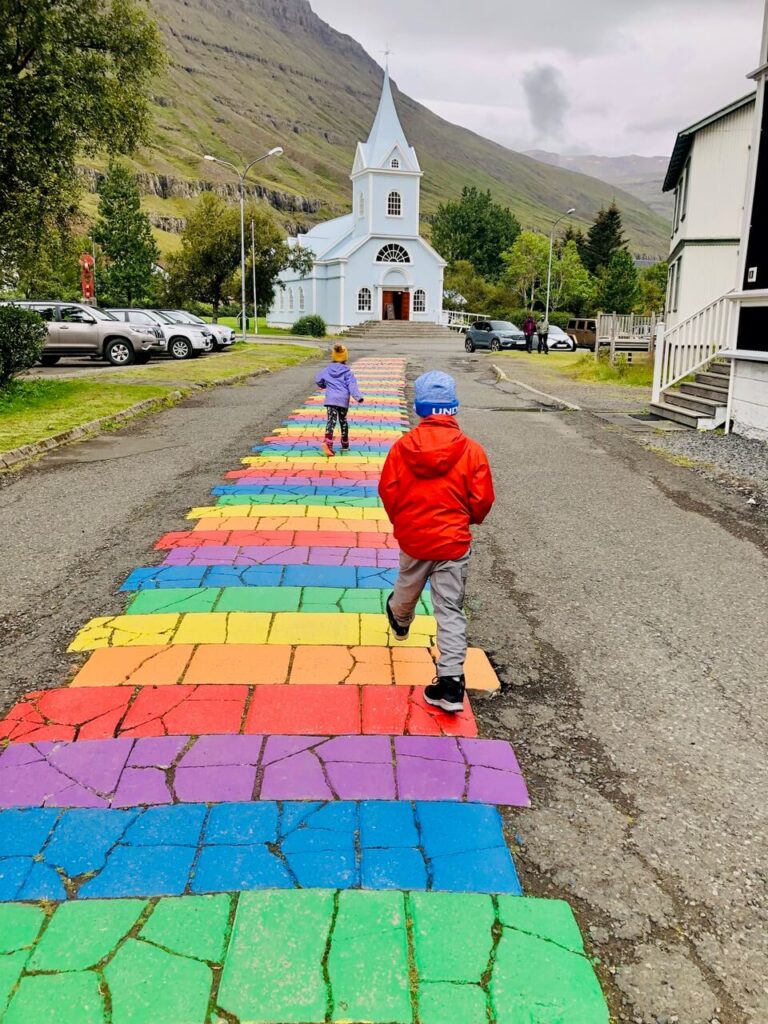
Seydisfjordur has a very quaint pedestrian centre, with an iconic rainbow pathway that leads to the church, and a beautiful coastline.
There is a campsite here, right across from the pedestrian area, if you want a scenic spot to camp. We drove back into Egilsstadir, for a more convenient start the following day.
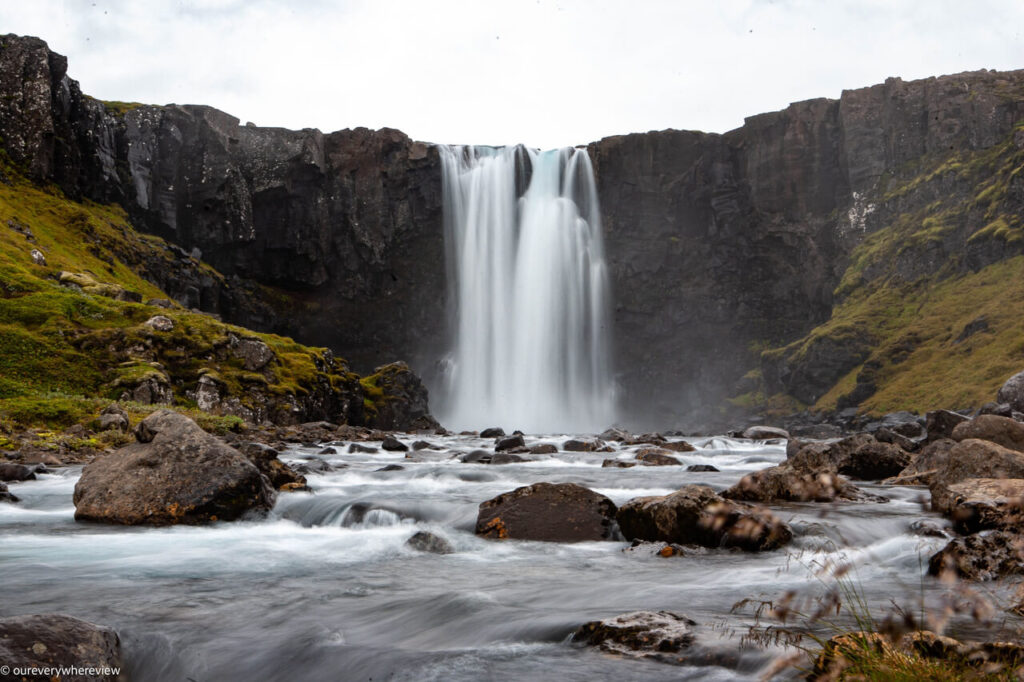
There is a photogenic waterfall just outside Seydisfjordur that is worth a stop – Gufufoss.
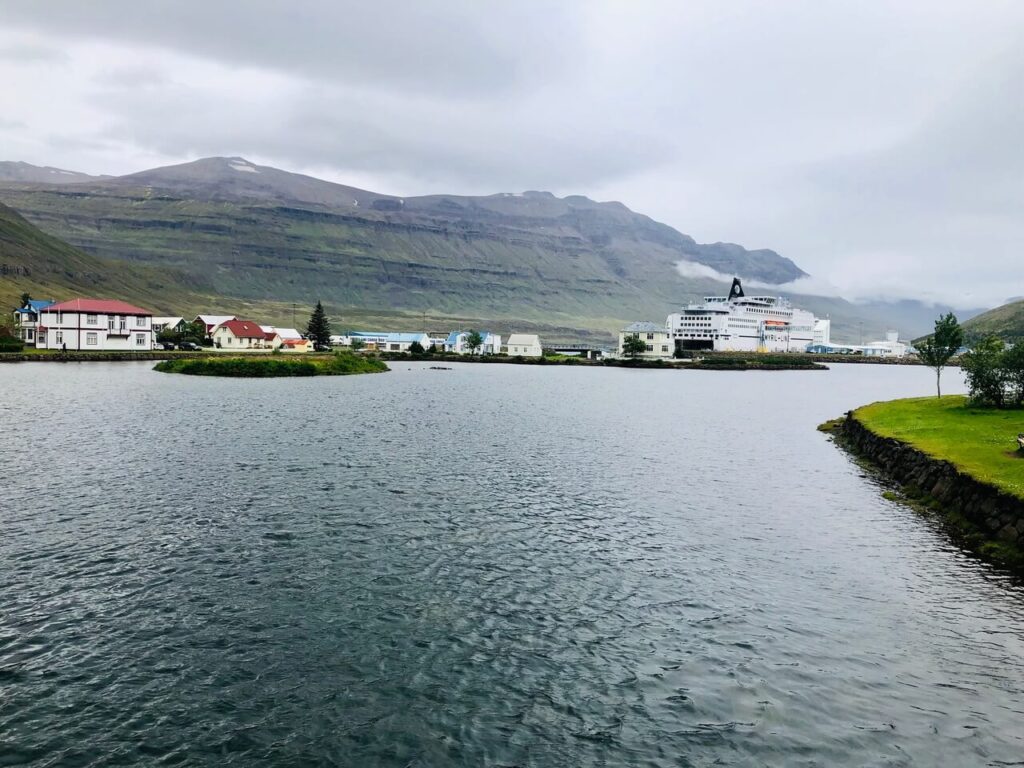
Egilsstadir
Egilsstadir is an urban centre, the largest town on the eastern coast. There are plenty of amenities and is a great place to stock up on gas and groceries. The campsite is conveniently located next to two major grocery chains, and there are many hotels in the area.
From Egilsstadir, we started along the Ring Road toward our adventure in Iceland’s blistery north. Check out the next instalment here.